



2027 A.T. Guide (Loose-Leaf)
Original price was: $24.95.$21.21Current price is: $21.21.
Weight: 8.3 oz.
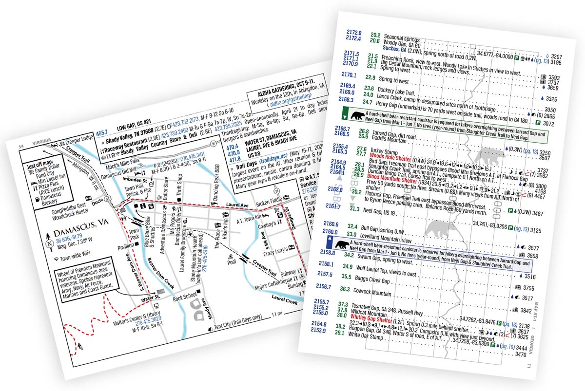
- Appalachian Trail guidebook for comprehensive hike preparation: features town maps, waypoints, elevation profiles, & expert information to plan an A.T. hike.
- Contains both northbound and southbound mileages for hiking in either direction.
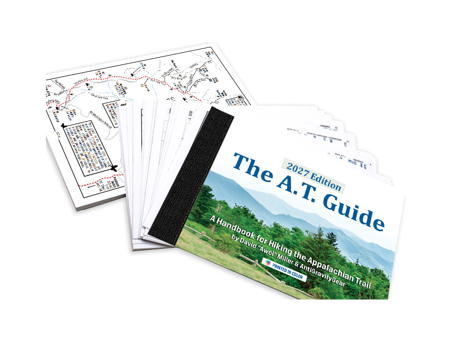
- Loose-leaf pages shipped in shrink-wrap. Film laminated full color cover is identical to the bound book.
- Comes with one (1) plastic slide lock bag. Purchase additional slide lock bags to divide the book into sections and carry only the part of the book you need for your hike.
- Weight: 8.3 oz.
- Dimensions:7.5" w x 5.25" h
- 240 Full color pages for ease of reading
In stock
Since 2010, The A.T. Guide, also known as The AWOL Guide, has been a trusted resource for Appalachian Trail hikers. Whether you're planning a thru-hike, section hike, or something in between, it's designed to give you the information you need to plan your hike and make informed decisions along the way.
The guide brings together detailed trail data, elevation profiles, town maps, and service information in one compact reference.
On the Trail
- Mile-by-mile landmarks for both northbound and southbound hikers.
- Elevation profiles aligned with trail landmarks, showing what's ahead and the terrain in between.
- Shelters, campsites, water sources, road crossings, summits, gaps, and other points of interest.
- Shelter listings with distances to surrounding shelters and information about water, tenting, privies, and food storage facilities.
Off the Trail
- 102 town and area maps to help with resupply and town logistics.
- Detailed listings for lodging, resupply, outfitters, shuttles, post offices, and other services.
- Services organized by trail access point and distance from the trail.
- Transportation options, parking information, and GPS coordinates at key access points.
The guide also includes information about permits, camping regulations, food storage, transportation, and other considerations that vary along the Appalachian Trail.
Each edition represents months of research, updates, and coordination with trail-maintaining clubs, the Appalachian Trail Conservancy, local businesses, shuttle providers, and hikers. Trail relocations, service changes, regulations, and other updates are incorporated each year to keep the information as current and useful as possible.
The A.T. Guide is built around a simple idea: give hikers accurate, practical information in a format that's easy to reference, whether they're planning at home or making decisions on the trail.
FAQs
Please contact us and tell us about it. We review new prospects starting in September each year. A decision for inclusion is is based on value to the hiker and available space.
Each year, The A.T. Guide works closely with the Appalachian Trail Conservancy (ATC) to reconcile Trail mileage, including relocations, reroutes, and other changes.
Our collaboration with ATC has improved significantly in recent years, allowing us to compare data, resolve discrepancies, and work toward consistent mileage across both publications before going to print.
Occasionally, small differences may still occur due to late-season Trail changes or publication deadlines. When necessary, we provide corrections and updates in our digital PDF and on our website.
Our goal is simple: accurate, consistent Trail data that hikers can rely on, with the Guide available in plenty of time to plan their hikes.
No. We simply trimmed the spine from a bound book and shrink wrapped the pages together. The pages are loose.
You may also like…


